Wireweed (Sargassum muticum)
Sargassum muticum, North Devon.
Photographer: Dr Keith Hiscock Copyright: Dr Keith Hiscock
Sargassum muticum as first discovered at Bembridge, Isle of Wight.
Photographer: Dr Gerald Boalch Copyright: Dr Gerald Boalch
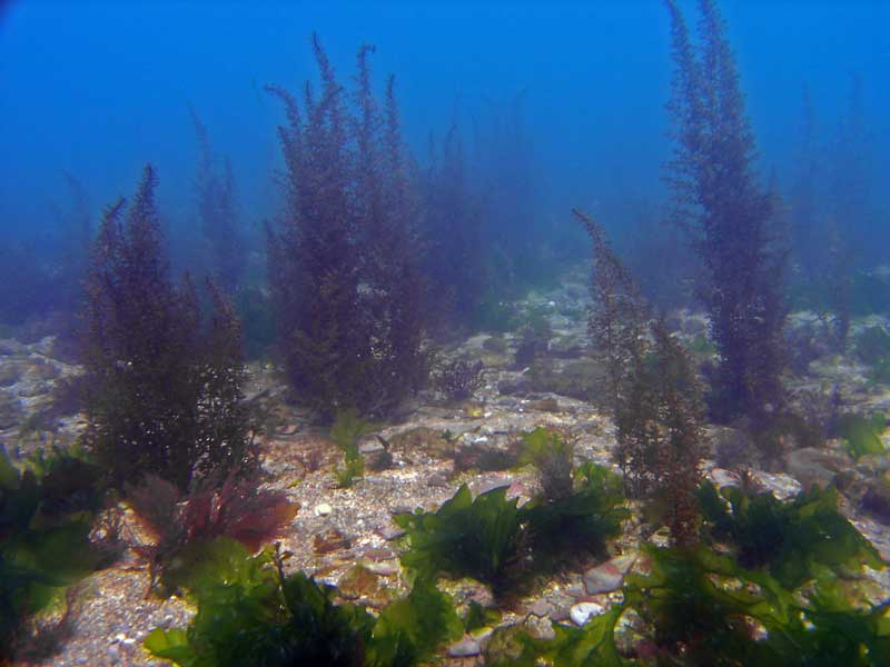
Sargassum muticum at South Milton Sands.
Photographer: Paul Newland Copyright: Paul Newland
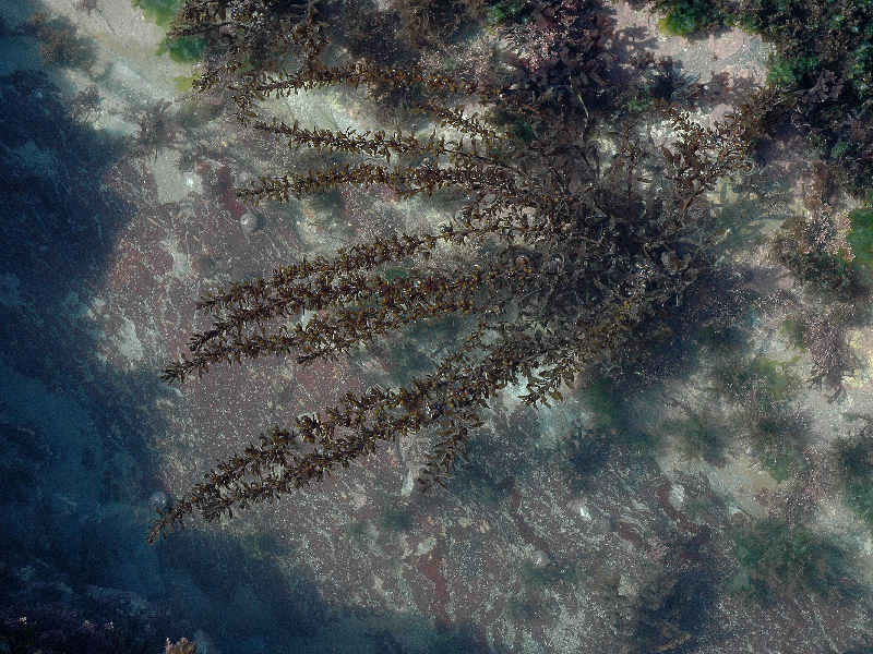
Sargassum muticum in very shallow water.
Photographer: Judith Oakley Copyright: Judith Oakley
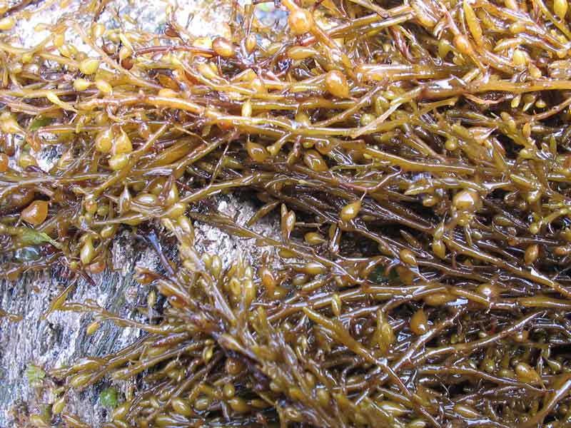
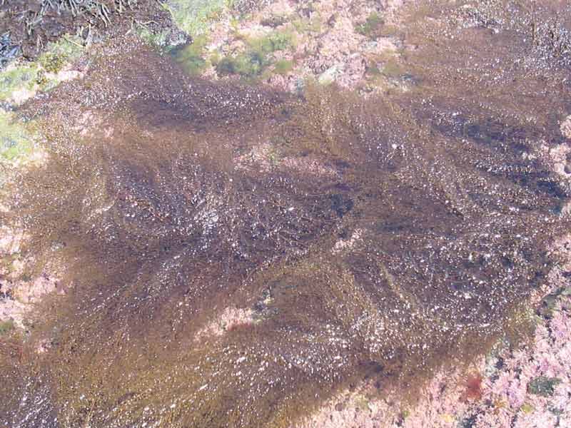
Sargassum muticum on a rocky surface.
Photographer: Judith Oakley Copyright: Judith Oakley
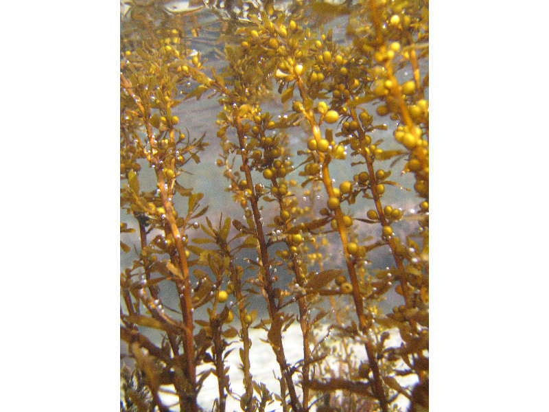
Close up of Sargassum muticum underwater showing air bladders.
Photographer: Jack Sewell Copyright: Jack Sewell
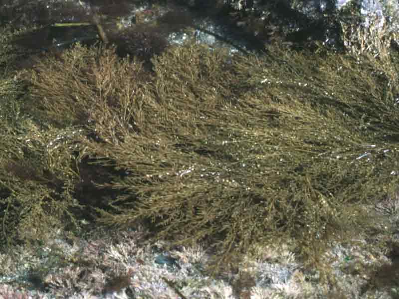
Wire weed on a rocky substrate.
Photographer: Dr Keith Hiscock Copyright: Dr Keith Hiscock
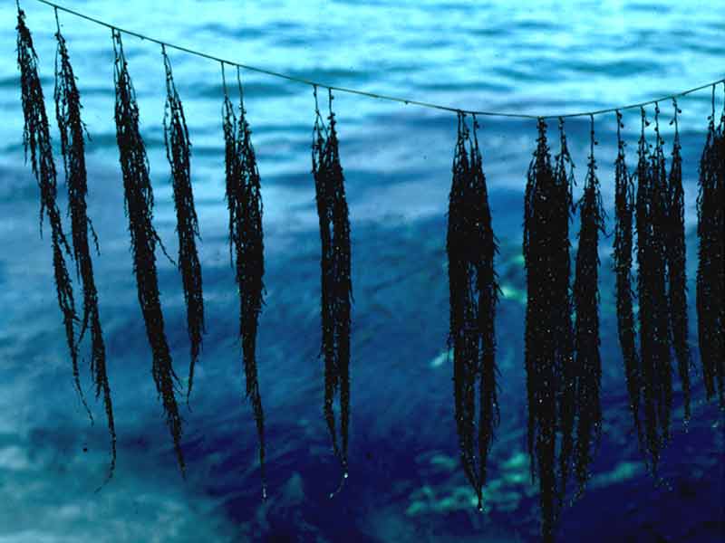
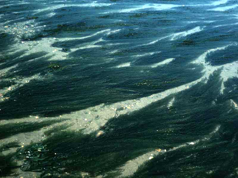
Wire weed out of water showing 'washing line' appearance.
Photographer: Dr Keith Hiscock Copyright: Dr Keith Hiscock
Distribution data supplied by the Ocean Biodiversity Information System (OBIS). To interrogate UK data visit the NBN Atlas.Map Help
| Researched by | Paolo Pizzolla | Refereed by | Admin |
| Authority | (Yendo) Fensholt, 1955 | ||
| Other common names | - | Synonyms | - |
Summary
Description
Recorded distribution in Britain and Ireland
Sargassum muticum has spread along the south coast to the Isles of Scilly and along the north Cornish coast to Lundy. Populations have also been recorded in Strangford Lough, Northern Ireland and Loch Ryan and the Firth of Clyde, Scotland.Global distribution
-Habitat
Grows on hard substrata in shallow waters and can also tolerate estuarine conditions. It can out-compete local species because it is fast growing, can reproduce within the first year of life and being monoecious can fertilize itself.Depth range
-Identifying features
- Fronds often more than 1 m in length.
- Olive-brown in colour.
- Regular alternating branches along stem.
- Flattened oval blades and spherical gas bladders along branches.
Additional information
Sargassum muticum is also known as 'Japweed' and 'Japanese weed'.Listed by
- none -
Bibliography
Hardy, F.G. & Guiry, M.D., 2003. A check-list and atlas of the seaweeds of Britain and Ireland. London: British Phycological Society
Hayward, P., Nelson-Smith, T. & Shields, C. 1996. Collins pocket guide. Sea shore of Britain and northern Europe. London: HarperCollins.
Howson, C.M. & Picton, B.E., 1997. The species directory of the marine fauna and flora of the British Isles and surrounding seas. Belfast: Ulster Museum. [Ulster Museum publication, no. 276.]
JNCC (Joint Nature Conservation Committee), 1999. Marine Environment Resource Mapping And Information Database (MERMAID): Marine Nature Conservation Review Survey Database. [on-line] http://www.jncc.gov.uk/mermaid
Norton, T.A. (ed.), 1985. Provisional Atlas of the Marine Algae of Britain and Ireland. Huntingdon: Biological Records Centre, Institute of Terrestrial Ecology.
Datasets
Centre for Environmental Data and Recording, 2018. Ulster Museum Marine Surveys of Northern Ireland Coastal Waters. Occurrence dataset https://www.nmni.com/CEDaR/CEDaR-Centre-for-Environmental-Data-and-Recording.aspx accessed via NBNAtlas.org on 2018-09-25.
Cofnod – North Wales Environmental Information Service, 2018. Records of Invasive Non Native Species held on the Cofnod database. Occurrence dataset: https://doi.org/10.15468/nxdbhu accessed via GBIF.org on 2018-09-25.
Fenwick, 2018. Aphotomarine. Occurrence dataset http://www.aphotomarine.com/index.html Accessed via NBNAtlas.org on 2018-10-01
Isle of Wight Local Records Centre, 2017. Isle of Wight non-native invasive species. Occurrence dataset:https://doi.org/10.15468/laa1k8 accessed via GBIF.org on 2018-09-27.
Kent Wildlife Trust, 2018. Biological survey of the intertidal chalk reefs between Folkestone Warren and Kingsdown, Kent 2009-2011. Occurrence dataset: https://www.kentwildlifetrust.org.uk/ accessed via NBNAtlas.org on 2018-10-01.
Kent Wildlife Trust, 2018. Kent Wildlife Trust Shoresearch Intertidal Survey 2004 onwards. Occurrence dataset: https://www.kentwildlifetrust.org.uk/ accessed via NBNAtlas.org on 2018-10-01.
Manx Biological Recording Partnership, 2017. Isle of Man wildlife records from 01/01/2000 to 13/02/2017. Occurrence dataset: https://doi.org/10.15468/mopwow accessed via GBIF.org on 2018-10-01.
Manx Biological Recording Partnership, 2018. Isle of Man historical wildlife records 1990 to 1994. Occurrence dataset: https://doi.org/10.15468/aru16v accessed via GBIF.org on 2018-10-01.
Merseyside BioBank., 2018. Merseyside BioBank (unverified). Occurrence dataset: https://doi.org/10.15468/iou2ld accessed via GBIF.org on 2018-10-01.
National Trust, 2017. National Trust Species Records. Occurrence dataset: https://doi.org/10.15468/opc6g1 accessed via GBIF.org on 2018-10-01.
Nature Locator, 2017. Sealife Tracker. Occurrence dataset: https://doi.org/10.15468/qgk3pg accessed via GBIF.org on 2018-10-01.
NBN (National Biodiversity Network) Atlas. Available from: https://www.nbnatlas.org.
OBIS (Ocean Biodiversity Information System), 2025. Global map of species distribution using gridded data. Available from: Ocean Biogeographic Information System. www.iobis.org. Accessed: 2025-08-01
Outer Hebrides Biological Recording, 2018. Invasive Non-Native Species, Outer Hebrides. Occurrence dataset: https://doi.org/10.15468/30erdy accessed via GBIF.org on 2018-10-01.
Royal Botanic Garden Edinburgh, 2018. Royal Botanic Garden Edinburgh Herbarium (E). Occurrence dataset: https://doi.org/10.15468/ypoair accessed via GBIF.org on 2018-10-02.
South East Wales Biodiversity Records Centre, 2018. INNS Data: All Taxa (South East Wales). Occurrence dataset: https://doi.org/10.15468/crhjs2 accessed via GBIF.org on 2018-10-02.
South East Wales Biodiversity Records Centre, 2018. SEWBReC Algae and allied species (South East Wales). Occurrence dataset: https://doi.org/10.15468/55albd accessed via GBIF.org on 2018-10-02.
West Wales Biodiversity Information Centre, 2018. INNS Data: All Taxa (West Wales). Occurrence dataset: https://doi.org/10.15468/ydifzd accessed via GBIF.org on 2018-10-02.
Citation
This review can be cited as:
Last Updated: 29/05/2008
