Cornish sucker (Lepadogaster purpurea)
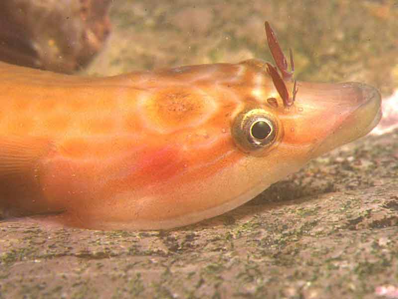
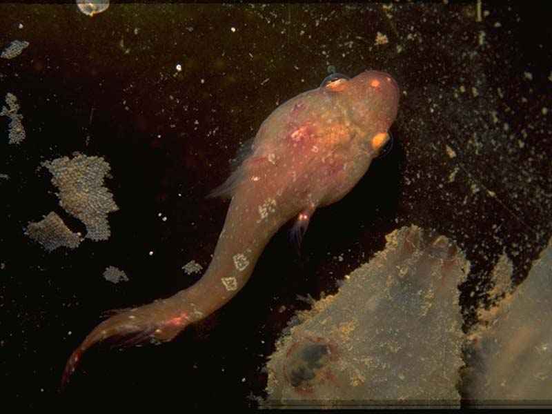
Lepadogaster lepadogaster, clingfish.
Photographer: Sue Daly Copyright: Sue Daly
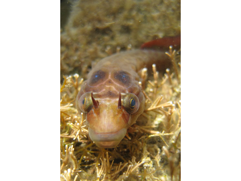
Lepadogaster lepadogaster
Photographer: Andy Pearson Copyright: Andrew Pearson
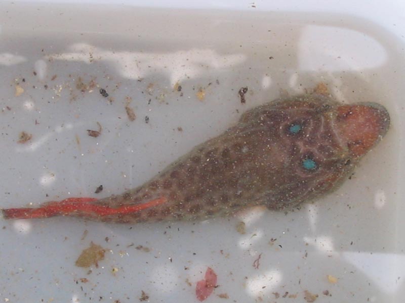
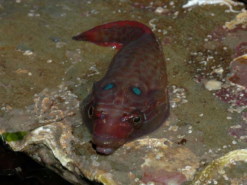
Lepadogaster lepadogaster in a tray clearly showing blue spots and a red tail.
Photographer: Judith Oakley Copyright: Judith Oakley
Lepadogaster lepadogaster in rockpool.
Photographer: Dr Keith Hiscock Copyright: Dr Keith Hiscock
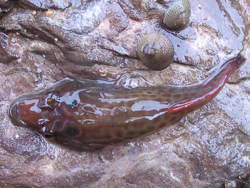
Lepadogaster lepadogaster next to a couple of topshells.
Photographer: Judith Oakley Copyright: Judith Oakley
Lepadogaster lepadogaster on a rock at Wembury.
Photographer: Judith Oakley Copyright: Judith Oakley

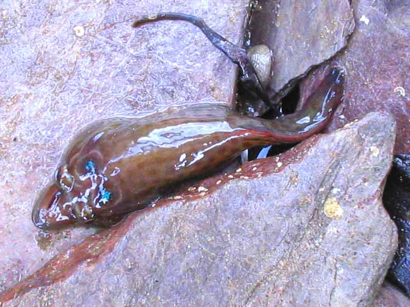
Lepadogaster lepadogaster with pebbles in a crevice.
Photographer: Judith Oakley Copyright: Judith Oakley
Lepadogaster lepadogaster.
Photographer: Sue Scott Copyright: Sue Scott
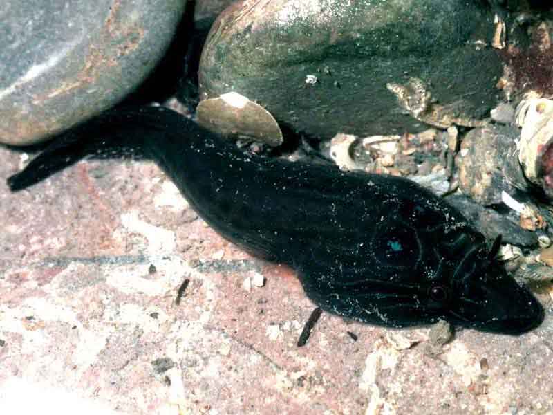
Brown Lepadogaster lepadogaster resting.
Photographer: Dr Keith Hiscock Copyright: Dr Keith Hiscock
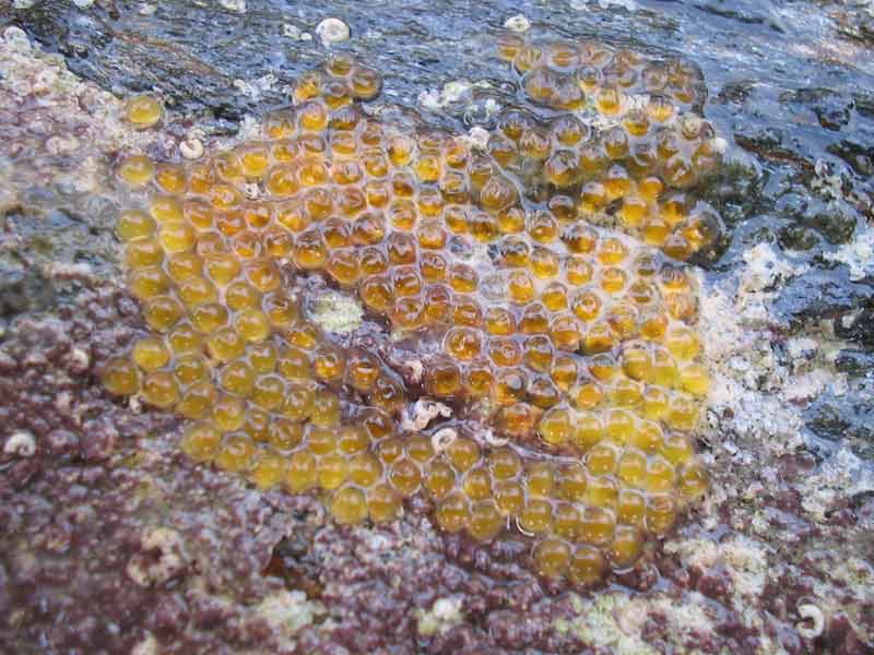
Eggs of shore clingfish.
Photographer: Judith Oakley Copyright: Judith Oakley
Distribution data supplied by the Ocean Biodiversity Information System (OBIS). To interrogate UK data visit the NBN Atlas.Map Help
| Researched by | Kate Reeds | Refereed by | Admin |
| Authority | (Bonnaterre, 1788) | ||
| Other common names | - | Synonyms | - |
Summary
Description
Recorded distribution in Britain and Ireland
South-west Scotland, Wales, Ireland to south-west England.Global distribution
Scotland, south to Senegal (west Africa), the Madeira and the Canary Islands, and the Mediterranean; possibly in the Black Sea.Habitat
The Cornish sucker Lepadogaster purpurea is an intertidal species inhabiting rock pools and seaweed covered shores throughout the year but with a preference for larger boulders. It is also found attached to the underside of overhanging rock crevices.Depth range
EulittoralIdentifying features
- Dorso-ventrally flattened body, up to 8 cm in length.
- 'Duck-billed' snout.
- Pelvic fins modified into a sucker with 5 or 6 rows of papillae at the front and 5 or 6 rows of papillae to the rear of the sucker.
- Large tentacles in front of each nostril.
- Blue spot behind each eye.
- Variable colour from reddish to green with irregular brown markings.
Additional information
The taxonomy of Lepadogaster spp. was revised by Henriques et al. (2002). In European waters, Lepadogaster spp. is represented by two species Lepadogaster purpurea and Lepadogaster lepadogaster (shore clingfish). They are distinguished by the two spots on the back of the head in L. purpurea while L. lepadogaster bears a large crescent shape on its back, and by the arrangement of the papillae of the sucker. In addition, the nose of L. purpurea is shorter and its eyes are more separated than those of L. lepadogaster (Henriques et al., 2002). Most importantly, their distribution varies but overlap. L. lepadogaster occurs from northern Spain (Galiza) south to north-west Africa, the Madeira and the Canary Islands, and the Mediterranean. L. purpurea occurs from Scotland, south to Senegal (west Africa), the Madeira and the Canary Islands, and the Mediterranean. Both species may occur on the coast of Morocco and in the Black Sea (Henriques et al., 2002). Therefore, prior records of L. lepadogaster in UK waters are probably L. purpurea and users should refer to distribution maps for both species (see Lepadogaster spp. on NBN Atlas).
The eggs are golden in colour and are laid underneath stones or attached to rocks. These are then guarded by either parent.
Listed by
- none -
Bibliography
Dipper, F., 2001. British sea fishes (2nd edn). Teddington: Underwater World Publications Ltd.
Hayward, P., Nelson-Smith, T. & Shields, C. 1996. Collins pocket guide. Sea shore of Britain and northern Europe. London: HarperCollins.
Howson, C.M. & Picton, B.E., 1997. The species directory of the marine fauna and flora of the British Isles and surrounding seas. Belfast: Ulster Museum. [Ulster Museum publication, no. 276.]
JNCC (Joint Nature Conservation Committee), 1999. Marine Environment Resource Mapping And Information Database (MERMAID): Marine Nature Conservation Review Survey Database. [on-line] http://www.jncc.gov.uk/mermaid
Picton, B.E. & Costello, M.J., 1998. BioMar biotope viewer: a guide to marine habitats, fauna and flora of Britain and Ireland. [CD-ROM] Environmental Sciences Unit, Trinity College, Dublin.
Wheeler, A., 1994. Field Key to the Shore Fishes of the British Isles. Shrewsbury: Field Studies Council.
- Henriques, M., Lourenço, R., Almada, F., Calado, G., Gonçalves, D., Guillemaud, T., Cancela, M.L. & Almada, V.C., 2002. A revision of the status of Lepadogaster lepadogaster (Teleostei: Gobiesocidae): sympatric subspecies or a long misunderstood blend of species? Biological Journal of the Linnean Society, 76 (3), 327-338. DOI https://doi.org/10.1046/j.1095-8312.2002.00067.x
Datasets
Centre for Environmental Data and Recording, 2018. Ulster Museum Marine Surveys of Northern Ireland Coastal Waters. Occurrence dataset https://www.nmni.com/CEDaR/CEDaR-Centre-for-Environmental-Data-and-Recording.aspx accessed via NBNAtlas.org on 2018-09-25.
Kent & Medway Biological Records Centre, 2017. Fish: Records for Kent. Occurrence dataset https://doi.org/10.15468/kd1utk accessed via GBIF.org on 2018-09-27.
Manx Biological Recording Partnership, 2017. Isle of Man wildlife records from 01/01/2000 to 13/02/2017. Occurrence dataset: https://doi.org/10.15468/mopwow accessed via GBIF.org on 2018-10-01.
Manx Biological Recording Partnership, 2018. Isle of Man historical wildlife records 1995 to 1999. Occurrence dataset: https://doi.org/10.15468/lo2tge accessed via GBIF.org on 2018-10-01.
NBN (National Biodiversity Network) Atlas. Available from: https://www.nbnatlas.org.
OBIS (Ocean Biodiversity Information System), 2025. Global map of species distribution using gridded data. Available from: Ocean Biogeographic Information System. www.iobis.org. Accessed: 2025-08-13
Citation
This review can be cited as:
Last Updated: 03/09/2020
