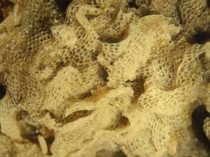
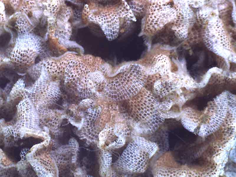
A sea mat (Einhornia crustulenta)
Distribution data supplied by the Ocean Biodiversity Information System (OBIS). To interrogate UK data visit the NBN Atlas.Map Help
| Researched by | Susie Ballerstedt | Refereed by | Admin |
| Authority | (Pallas, 1766) | ||
| Other common names | - | Synonyms | Electra crustulenta |
Summary
Description
Einhornia crustulenta forms encrusting mats, large erect clumps or foliage-like cylinders around the stems of plants. Individuals (zooids) of the colony can be elongate, rectangular or oval, separated by narrow grooves and are approximately 0.5 mm long and 0.3 mm wide. The upper surface (frontal surface) of zooids is covered by about three quarters membrane and one quarter calcified shield (gymnocyst). The zooids are white and the operculum (door to the zooid orifice) is opaque white. Electra crustulenta zooids has crenulate margins with a single short spine.
Recorded distribution in Britain and Ireland
Only recorded at a few isolated sites: Loch of Stenness, Orkney Islands; Poole Harbour, Dorset; Devon/Cornwall coast; the River Severn; and Loch Foyle, Northern Ireland.Global distribution
Present in the Baltic, the Netherlands, south North Sea and western Mediterranean.Habitat
Limited to estuarine habitats. Found on various substrata from low shore to shallow water, including fronds of fucoidsDepth range
-Identifying features
- Einhornia crustulenta forms mats, clumps or foliage-like structures.
- Individuals (zooids) are approx. 0.5 mm long and 0.3 mm wide.
- The margin bears a single short spine.
Additional information
No text entered
Listed by
- none -
Bibliography
Hayward, P., Nelson-Smith, T. & Shields, C. 1996. Collins pocket guide. Sea shore of Britain and northern Europe. London: HarperCollins.
Hayward, P.J. & Ryland, J.S. (ed.) 1995b. Handbook of the marine fauna of North-West Europe. Oxford: Oxford University Press.
Hayward, P.J. & Ryland, J.S. 1998. Cheilostomatous Bryozoa. Part 1. Aeteoidea - Cribrilinoidea. Shrewsbury: Field Studies Council. [Synopses of the British Fauna, no. 10. (2nd edition)]
Datasets
Bristol Regional Environmental Records Centre, 2017. BRERC species records recorded over 15 years ago. Occurrence dataset: https://doi.org/10.15468/h1ln5p accessed via GBIF.org on 2018-09-25.
NBN (National Biodiversity Network) Atlas. Available from: https://www.nbnatlas.org.
Norfolk Biodiversity Information Service, 2017. NBIS Records to December 2016. Occurrence dataset: https://doi.org/10.15468/jca5lo accessed via GBIF.org on 2018-10-01.
OBIS (Ocean Biodiversity Information System), 2025. Global map of species distribution using gridded data. Available from: Ocean Biogeographic Information System. www.iobis.org. Accessed: 2025-08-08
South East Wales Biodiversity Records Centre, 2023. SEWBReC Marine and other Aquatic Invertebrates (South East Wales). Occurrence dataset:https://doi.org/10.15468/zxy1n6 accessed via GBIF.org on 2024-09-27.
Suffolk Biodiversity Information Service., 2017. Suffolk Biodiversity Information Service (SBIS) Dataset. Occurrence dataset: https://doi.org/10.15468/ab4vwo accessed via GBIF.org on 2018-10-02.
Citation
This review can be cited as:
Last Updated: 06/04/2006


