Discoid fork weed (Polyides rotunda)
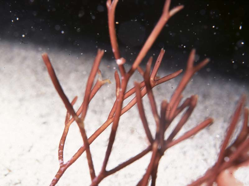
Polyides rotunda.
Photographer: Jason Hall-Spencer Copyright: Scottish Natural Heritage (SNH)
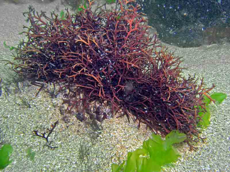
Polyidea rotunda in shallow water at Outer Hope, Devon
Photographer: Paul Newland Copyright: Paul Newland
Distribution data supplied by the Ocean Biodiversity Information System (OBIS). To interrogate UK data visit the NBN Atlas.Map Help
| Researched by | Will Rayment | Refereed by | Admin |
| Authority | (Hudson) Gaillon, 1828 | ||
| Other common names | - | Synonyms | Polyides caprinus , Polyides caprinus (Hudson) Gaillon, 1828, Polyides rotundus |
Summary
Description
A dark red or blackish seaweed with smooth, cartilaginous, cylindrical fronds, branching dichotomously in roughly the same plane. The fronds rise from a fleshy, discoid holdfast up to 2 cm in diameter. The reproductive bodies occur as oval shaped swellings along the sides of the branches or occasionally encircling them. The seaweed grows up to 20 cm in length.
Recorded distribution in Britain and Ireland
Occurs around all coasts of Britain and Ireland. There is a paucity of records from south east England which may reflect a lack of suitable substrata.Global distribution
In Europe, occurs from the Arctic Ocean to northern Spain and in the Baltic Sea. In North America, occurs from the Hudson Straits to New York.Habitat
Grows attached to rock and stones in pools in the lower intertidal and subtidally to 20 m. The holdfast is often buried by coarse, sandy deposits.Depth range
-Identifying features
- erect, cylindrical, dichotomously branching fronds.
- fleshy, discoid holdfast.
- dull red in colour, blackish when dry.
- tetrasporangia cruciate or irregular, borne on uppermost branches which become slightly thickened.
- cystocarps produced in oval, spongy, wart-like growths on one side of, or encircling, branch.
- spermatangia thin, plate-like and colourless.
Additional information
-none-Listed by
- none -
Bibliography
Dickinson, C.I., 1963. British seaweeds. London & Frome: Butler & Tanner Ltd.
Dixon, P.S. & Irvine, L.M., 1977. Seaweeds of the British Isles. Volume 1 Rhodophyta. Part 1 Introduction, Nemaliales, Gigartinales. London: British Museum (Natural History) London.
Fish, J.D. & Fish, S., 1996. A student's guide to the seashore. Cambridge: Cambridge University Press.
Hardy, F.G. & Guiry, M.D., 2003. A check-list and atlas of the seaweeds of Britain and Ireland. London: British Phycological Society
JNCC (Joint Nature Conservation Committee), 1999. Marine Environment Resource Mapping And Information Database (MERMAID): Marine Nature Conservation Review Survey Database. [on-line] http://www.jncc.gov.uk/mermaid
Picton, B.E. & Costello, M.J., 1998. BioMar biotope viewer: a guide to marine habitats, fauna and flora of Britain and Ireland. [CD-ROM] Environmental Sciences Unit, Trinity College, Dublin.
Datasets
Centre for Environmental Data and Recording, 2018. Ulster Museum Marine Surveys of Northern Ireland Coastal Waters. Occurrence dataset https://www.nmni.com/CEDaR/CEDaR-Centre-for-Environmental-Data-and-Recording.aspx accessed via NBNAtlas.org on 2018-09-25.
Fenwick, 2018. Aphotomarine. Occurrence dataset http://www.aphotomarine.com/index.html Accessed via NBNAtlas.org on 2018-10-01
Kent Wildlife Trust, 2018. Biological survey of the intertidal chalk reefs between Folkestone Warren and Kingsdown, Kent 2009-2011. Occurrence dataset: https://www.kentwildlifetrust.org.uk/ accessed via NBNAtlas.org on 2018-10-01.
Kent Wildlife Trust, 2018. Kent Wildlife Trust Shoresearch Intertidal Survey 2004 onwards. Occurrence dataset: https://www.kentwildlifetrust.org.uk/ accessed via NBNAtlas.org on 2018-10-01.
NBN (National Biodiversity Network) Atlas. Available from: https://www.nbnatlas.org.
OBIS (Ocean Biodiversity Information System), 2025. Global map of species distribution using gridded data. Available from: Ocean Biogeographic Information System. www.iobis.org. Accessed: 2025-08-08
Outer Hebrides Biological Recording, 2018. Non-vascular Plants, Outer Hebrides. Occurrence dataset: https://doi.org/10.15468/goidos accessed via GBIF.org on 2018-10-01.
Royal Botanic Garden Edinburgh, 2018. Royal Botanic Garden Edinburgh Herbarium (E). Occurrence dataset: https://doi.org/10.15468/ypoair accessed via GBIF.org on 2018-10-02.
Citation
This review can be cited as:
Last Updated: 01/07/2003
