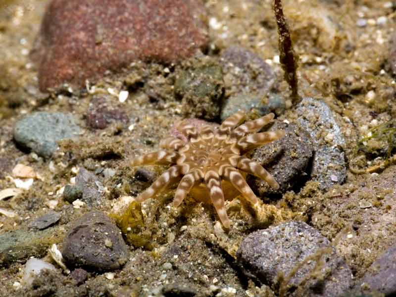
A sea anemone (Halcampa chrysanthellum)
Distribution data supplied by the Ocean Biodiversity Information System (OBIS). To interrogate UK data visit the NBN Atlas.Map Help
| Researched by | Susie Ballerstedt | Refereed by | Admin |
| Authority | (Peach in Johnston, 1847) | ||
| Other common names | - | Synonyms | - |
Summary
Description
Recorded distribution in Britain and Ireland
Recorded at locations on most coasts of Britain and Ireland.Global distribution
Coasts of NW France round to the Mediterranean.Habitat
Halcampa chrysanthellum burrows in mud, sand or gravel from the low shore to about 100 m depth offshore, often in the region of eelgrass (Zostera marina) beds. It is occasionally found under stones.Depth range
-Identifying features
- Column is 'worm-like', up to 5 cm long and 5 mm diameter.
- 12 short tentacles on oral disc.
- Small oral disc.
- Oral disc patterned in shades of brown on pale background.
Additional information
No text enteredListed by
- none -
Bibliography
Hayward, P., Nelson-Smith, T. & Shields, C. 1996. Collins pocket guide. Sea shore of Britain and northern Europe. London: HarperCollins.
Hayward, P.J. & Ryland, J.S. (ed.) 1995b. Handbook of the marine fauna of North-West Europe. Oxford: Oxford University Press.
Manuel, R.L., 1988. British Anthozoa. Synopses of the British Fauna (New Series) (ed. D.M. Kermack & R.S.K. Barnes). The Linnean Society of London [Synopses of the British Fauna No. 18.]. DOI https://doi.org/10.1002/iroh.19810660505
Datasets
Centre for Environmental Data and Recording, 2018. Ulster Museum Marine Surveys of Northern Ireland Coastal Waters. Occurrence dataset https://www.nmni.com/CEDaR/CEDaR-Centre-for-Environmental-Data-and-Recording.aspx accessed via NBNAtlas.org on 2018-09-25.
Isle of Wight Local Records Centre, 2017. IOW Natural History & Archaeological Society Marine Invertebrate Records 1853- 2011. Occurrence dataset: https://doi.org/10.15468/d9amhg accessed via GBIF.org on 2018-09-27.
NBN (National Biodiversity Network) Atlas. Available from: https://www.nbnatlas.org.
OBIS (Ocean Biodiversity Information System), 2025. Global map of species distribution using gridded data. Available from: Ocean Biogeographic Information System. www.iobis.org. Accessed: 2025-07-04
Citation
This review can be cited as:
Last Updated: 23/06/2008


