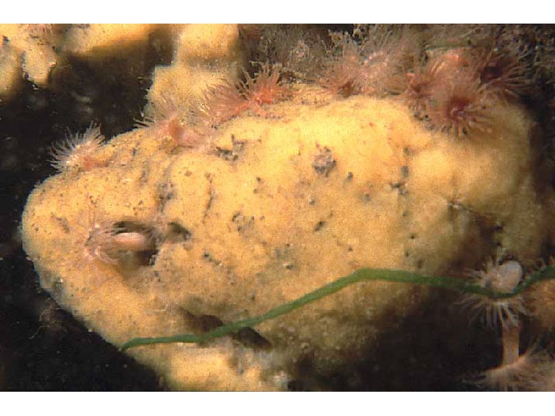
A sponge (Suberites massa)
Distribution data supplied by the Ocean Biodiversity Information System (OBIS). To interrogate UK data visit the NBN Atlas.Map Help
| Researched by | Penny Avant | Refereed by | Admin |
| Authority | Nardo, 1847 | ||
| Other common names | - | Synonyms | - |
Summary
Description
Recorded distribution in Britain and Ireland
Suberites massa has also been recorded in the Stour Estuary on the east coast of England (Essex / Suffolk boundary). It has also been reported at 3 sites on the south coast of England; Torbay, Fleet Lagoon, and in Poole Harbour.
Global distribution
Occurs south from Britain around the coast of France and northern Spain, and around the north coast of the Mediterranean.
Habitat
Suberites massa is found in harbours, estuaries and inlets, where the salinity may be variable, the turbidity high and there are moderate to strong tidal currents. It colonizes hard substrata such as rock, walls, boulders, stones and shells, and it may become free standing where it overgrows these. In the few sites in Britain that it has been recorded it occurs sublittorally although it may occur on shaded areas at extreme low water.
Depth range
-Identifying features
- Massive hemispheroidal sponge, orange or whitish-yellow in colour, up to 30 cm in height and 10 cm in diameter.
- Body composed of irregular connecting ridges that have small pores, or oscula, on the surface.
- The surface is fairly firm and slightly rough to touch.
- There is significant contraction of body size out of water.
- The skeleton consists of siliceous spicules classified as tylostyles (pin-like with a pinched bulbous end) requiring microscopic examination for identification, and arranged radially.
Additional information
No text enteredListed by
- none -
Bibliography
Hayward, P.J. & Ryland, J.S. (ed.) 1995b. Handbook of the marine fauna of North-West Europe. Oxford: Oxford University Press.
Howson, C.M. & Picton, B.E., 1997. The species directory of the marine fauna and flora of the British Isles and surrounding seas. Belfast: Ulster Museum. [Ulster Museum publication, no. 276.]
JNCC (Joint Nature Conservation Committee), 1999. Marine Environment Resource Mapping And Information Database (MERMAID): Marine Nature Conservation Review Survey Database. [on-line] http://www.jncc.gov.uk/mermaid
Van Soest, R.W.M., Picton, B. & Morrow, C., 2000. Sponges of the North East Atlantic. [CD-ROM] Windows version 1.0. Amsterdam: Biodiversity Center of ETI, Multimedia Interactive Software. [World Biodiversity Database CD-ROM Series.]
Datasets
Kent Wildlife Trust, 2018. Kent Wildlife Trust Shoresearch Intertidal Survey 2004 onwards. Occurrence dataset: https://www.kentwildlifetrust.org.uk/ accessed via NBNAtlas.org on 2018-10-01.
National Trust, 2017. National Trust Species Records. Occurrence dataset: https://doi.org/10.15468/opc6g1 accessed via GBIF.org on 2018-10-01.
NBN (National Biodiversity Network) Atlas. Available from: https://www.nbnatlas.org.
OBIS (Ocean Biodiversity Information System), 2025. Global map of species distribution using gridded data. Available from: Ocean Biogeographic Information System. www.iobis.org. Accessed: 2025-08-14
Citation
This review can be cited as:
Last Updated: 13/05/2005


