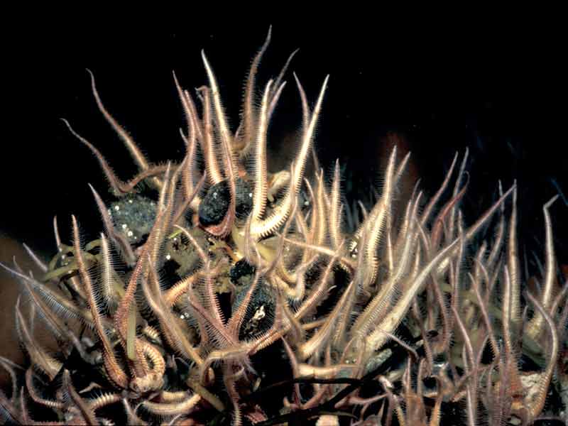
Crevice brittlestar (Ophiopholis aculeata)
Ophiopholis aculeata
Photographer: Dr Keith Hiscock Copyright: Dr Keith Hiscock
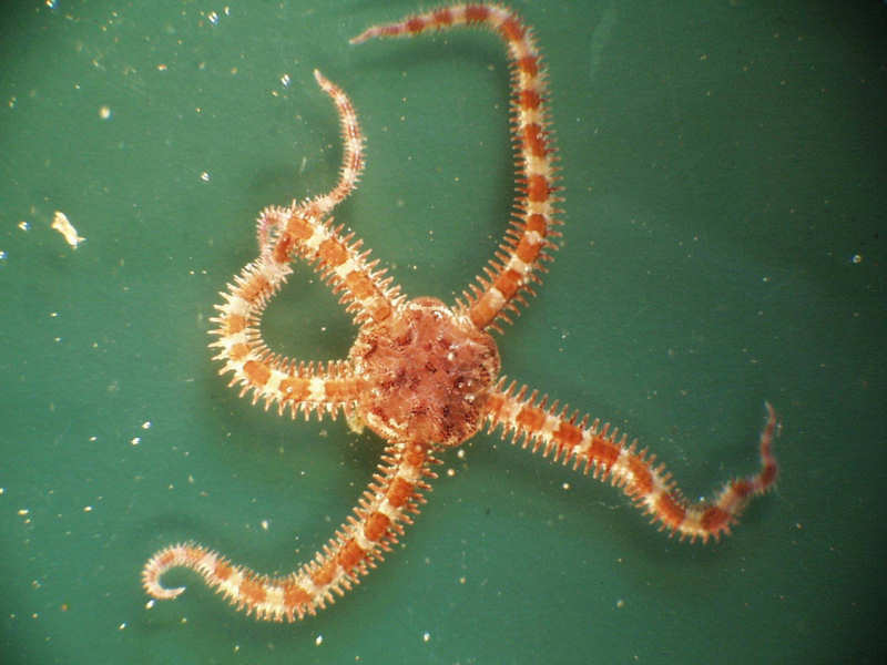
Ophiopholis aculeata specimen, approximately 10 cm across.
Photographer: Hilmar Hinz Copyright: Dr Hilmar Hinz
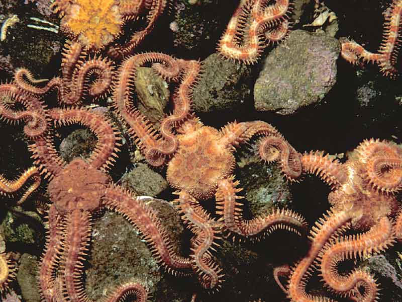
Bed of the brittlestar Ophiopholis aculeata.
Photographer: Dr Keith Hiscock Copyright: Dr Keith Hiscock
Distribution data supplied by the Ocean Biodiversity Information System (OBIS). To interrogate UK data visit the NBN Atlas.Map Help
| Researched by | Michelle Carter | Refereed by | Admin |
| Authority | (Linnaeus, 1767) | ||
| Other common names | - | Synonyms | - |
Summary
Description
A large brittlestar with twisted arms that are conspicuously banded. The disc is pentagonal and covered with regular rounded plates. The arms are thick and segmented, with 6-7 short thick spines encircling each segment with one small spine being transformed into a hook. The dorsal surface of the arms has a single series of oval plates along its midline each surrounded by a ring of smaller plates. The colour is mainly red but often variegated and, more rarely, the disc may be bluish. The disc is approximately 15 mm across and the arms are 4x disc diameter in length.
Recorded distribution in Britain and Ireland
Widely distributed around Britain and Ireland. Most conspicuous and abundant in Northern waters.Global distribution
This species has a circumpolar distribution, including Spitsbergen, the Barents Sea, the coast of Norway, the North Sea, Iceland, Greenland, North America and Japan.Habitat
Commonly found in the crevices of rocks amongst horse mussels or under rocks and shells. May form dense beds in tidal sounds in Scotland. Lives in rock pools and can be found to depths of 2000 m.Depth range
-Identifying features
- Twisted robust arms emerging from crevices.
- Arms with a series of large plates each surrounded by a ring of small ones.
- Mainly red in colour, often variegated.
- Dark banding on the arms.
Additional information
This species avoids light and prefers to hide beneath rocks, under shells or among seaweed. By virtue of their long flexible arms this species is well adapted for attaching itself to other animals.
Listed by
- none -
Bibliography
Howson, C.M. & Picton, B.E., 1997. The species directory of the marine fauna and flora of the British Isles and surrounding seas. Belfast: Ulster Museum. [Ulster Museum publication, no. 276.]
Hyman, L.V., 1955. The Invertebrates: Vol. IV. Echinodermata. The coelomate Bilateria. New York: McGraw Hill.
JNCC (Joint Nature Conservation Committee), 1999. Marine Environment Resource Mapping And Information Database (MERMAID): Marine Nature Conservation Review Survey Database. [on-line] http://www.jncc.gov.uk/mermaid
Mortensen, T.H., 1927. Handbook of the echinoderms of the British Isles. London: Humphrey Milford, Oxford University Press.
Picton, B.E., 1993. A field guide to the shallow-water echinoderms of the British Isles. London: Immel Publishing Ltd.
Datasets
Centre for Environmental Data and Recording, 2018. IBIS Project Data. Occurrence dataset: https://www.nmni.com/CEDaR/CEDaR-Centre-for-Environmental-Data-and-Recording.aspx accessed via NBNAtlas.org on 2018-09-25.
Centre for Environmental Data and Recording, 2018. Ulster Museum Marine Surveys of Northern Ireland Coastal Waters. Occurrence dataset https://www.nmni.com/CEDaR/CEDaR-Centre-for-Environmental-Data-and-Recording.aspx accessed via NBNAtlas.org on 2018-09-25.
Environmental Records Information Centre North East, 2018. ERIC NE Combined dataset to 2017. Occurrence dataset: http://www.ericnortheast.org.ukl accessed via NBNAtlas.org on 2018-09-38
Kent Wildlife Trust, 2018. Kent Wildlife Trust Shoresearch Intertidal Survey 2004 onwards. Occurrence dataset: https://www.kentwildlifetrust.org.uk/ accessed via NBNAtlas.org on 2018-10-01.
Manx Biological Recording Partnership, 2022. Isle of Man historical wildlife records 1990 to 1994. Occurrence dataset:https://doi.org/10.15468/aru16v accessed via GBIF.org on 2024-09-27.
NBN (National Biodiversity Network) Atlas. Available from: https://www.nbnatlas.org.
OBIS (Ocean Biodiversity Information System), 2025. Global map of species distribution using gridded data. Available from: Ocean Biogeographic Information System. www.iobis.org. Accessed: 2025-05-21
Citation
This review can be cited as:
Last Updated: 16/10/2006
