A feather star (Antedon petasus)
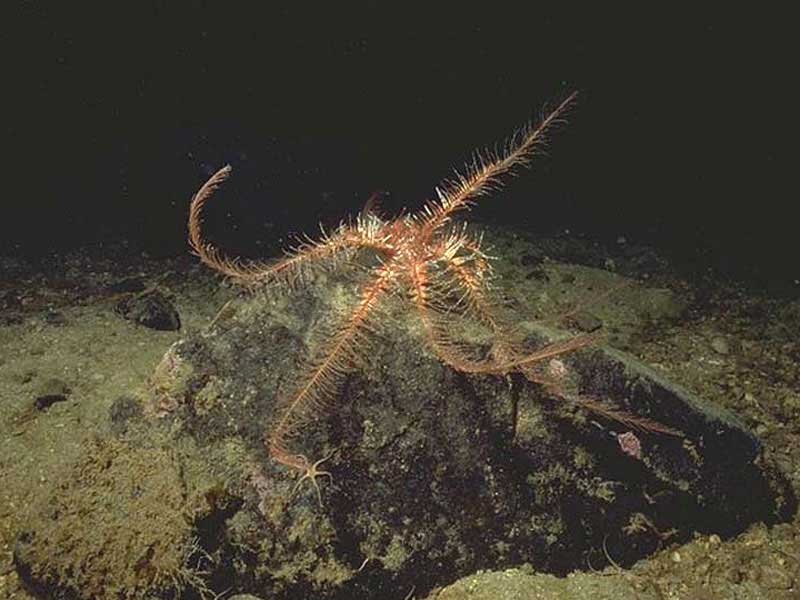
Antedon petasus featherstar.
Photographer: Sue Scott Copyright: Sue Scott
Distribution data supplied by the Ocean Biodiversity Information System (OBIS). To interrogate UK data visit the NBN Atlas.Map Help
| Researched by | Jessica Heard | Refereed by | Admin |
| Authority | (Düben & Koren, 1846) | ||
| Other common names | - | Synonyms | - |
Summary
Description
Recorded distribution in Britain and Ireland
Generally a northern species in Britain and Ireland. Common in the northern part of the Irish Sea and inshore in the west coast of Scotland.Global distribution
-Habitat
Usually found in sheltered to moderately exposed habitats attached directly to wrecks, hard substratum or kelp and sessile animals. Commonly found at depths of 20 to several hundred metres.Depth range
-Identifying features
- Ten orderly arranged feather-like arms
- 50 short banded cirri
- Lower side of branchials and pinnules smooth.
- Pinnule joints gradually decrease in size.
- Outer edge of branchials is not thickened and prominent.
Additional information
Antedon petasus may be confused with the smaller feather star Antedon bifida which has a banded colour pattern of red, pink, orange or yellow and less 30 short cirri on the undersurface of the central disc. Although Antedon petasus is less common than Antedon bifida they are found in similar locations, Antedon petasus being more dominant in northern deep waters.Listed by
- none -
Bibliography
Howson, C.M. & Picton, B.E., 1997. The species directory of the marine fauna and flora of the British Isles and surrounding seas. Belfast: Ulster Museum. [Ulster Museum publication, no. 276.]
JNCC (Joint Nature Conservation Committee), 1999. Marine Environment Resource Mapping And Information Database (MERMAID): Marine Nature Conservation Review Survey Database. [on-line] http://www.jncc.gov.uk/mermaid
MarLIN (Marine Life Information Network), 2005. SEArchable BEnthic Data (SEABED) Map [on-line]. Data Access Sub-programme, Marine Life Information Network for Britian and Ireland http://www.marlin.ac.uk,
Mortensen, T.H., 1927. Handbook of the echinoderms of the British Isles. London: Humphrey Milford, Oxford University Press.
Nichols, D., 1969. Echinoderms (4th ed.). London: Hutchinson & Co.
Picton, B.E. & Costello, M.J., 1998. BioMar biotope viewer: a guide to marine habitats, fauna and flora of Britain and Ireland. [CD-ROM] Environmental Sciences Unit, Trinity College, Dublin.
Picton, B.E., 1993. A field guide to the shallow-water echinoderms of the British Isles. London: Immel Publishing Ltd.
Datasets
NBN (National Biodiversity Network) Atlas. Available from: https://www.nbnatlas.org.
OBIS (Ocean Biodiversity Information System), 2025. Global map of species distribution using gridded data. Available from: Ocean Biogeographic Information System. www.iobis.org. Accessed: 2025-07-25
Citation
This review can be cited as:
Last Updated: 09/01/2007
