Black sea bream (Spondyliosoma cantharus)
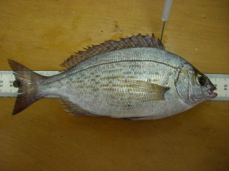
Freshly caught adult Spondyliosoma cantharus.
Photographer: Andrew Marriott Copyright: Andrew Marriott
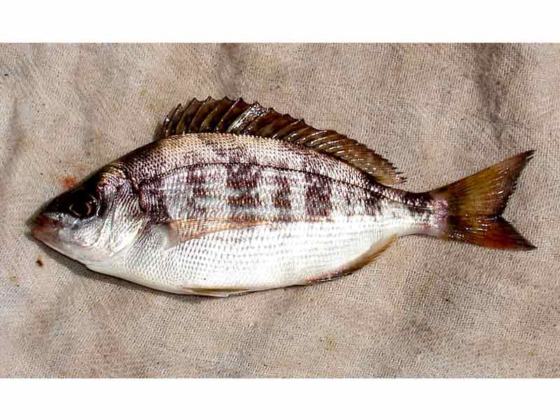
Spondyliosoma cantharus in Newlyn
Photographer: John Brooks Copyright: John Brooks
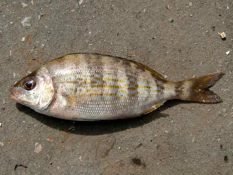
A juvenile black sea-bream
Photographer: David Fenwick Copyright: David Fenwick Snr.
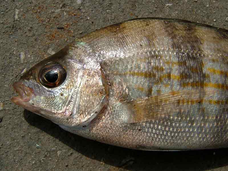
The head of a juvenile black sea-bream
Photographer: David Fenwick Copyright: David Fenwick Snr.
Distribution data supplied by the Ocean Biodiversity Information System (OBIS). To interrogate UK data visit the NBN Atlas.Map Help
| Researched by | Ana Ruiz | Refereed by | Admin |
| Authority | (Linnaeus, 1758) | ||
| Other common names | - | Synonyms | - |
Summary
Description
Recorded distribution in Britain and Ireland
Found off south-west Britain and east Ireland in the English Channel and the Irish Sea.Global distribution
-Habitat
Found over seagrass beds and rocky and sandy bottoms down to about 300 m.Depth range
-Identifying features
- A large silvery fish.
- A single long dorsal fin.
- A small mouth.
- Black rim on tail (especially in young fish).
Additional information
Spawning occurs in April and May. The Black sea bream lays its eggs on a nest that the male excavates on the sand with its tail. Black sea bream is a hermaphrodite and undergoes a change in sex during its life. It is omnivorous, feeding on seaweeds and small invertebrates, especially crustaceans. It is an important food fish.Listed by
- none -
Bibliography
Dipper, F., 2001. British sea fishes (2nd edn). Teddington: Underwater World Publications Ltd.
Howson, C.M. & Picton, B.E., 1997. The species directory of the marine fauna and flora of the British Isles and surrounding seas. Belfast: Ulster Museum. [Ulster Museum publication, no. 276.]
Quero, J-C., Hureau, J-C., Karrer, C., Post, A. & Saldanha, L. (eds.), 1990. Check-list of the fishes of the eastern tropical Atlantic (CLOFETA) JNICT, Lisbon; SEI, Paris; and UNESCO, Paris.
Datasets
Fenwick, 2018. Aphotomarine. Occurrence dataset http://www.aphotomarine.com/index.html Accessed via NBNAtlas.org on 2018-10-01
Isle of Wight Local Records Centre, 2017. IOW Natural History & Archaeological Society Marine Records. Occurrence dataset: https://doi.org/10.15468/7axhcw accessed via GBIF.org on 2018-09-27.
Kent & Medway Biological Records Centre, 2017. Fish: Records for Kent. Occurrence dataset https://doi.org/10.15468/kd1utk accessed via GBIF.org on 2018-09-27.
NBN (National Biodiversity Network) Atlas. Available from: https://www.nbnatlas.org.
OBIS (Ocean Biodiversity Information System), 2025. Global map of species distribution using gridded data. Available from: Ocean Biogeographic Information System. www.iobis.org. Accessed: 2025-07-26
Citation
This review can be cited as:
Last Updated: 17/04/2008
