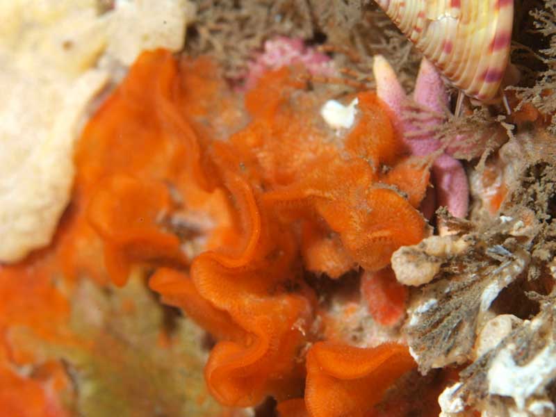
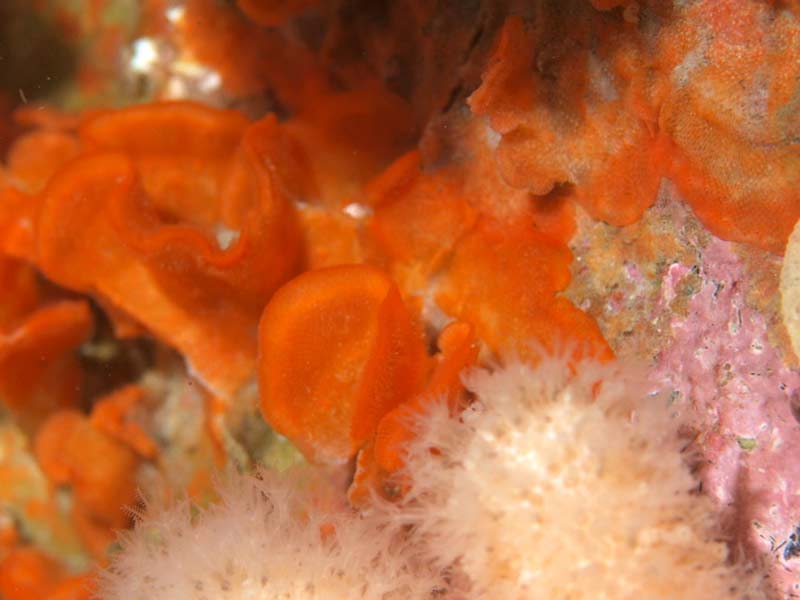
A bryozoan (Smittina landsborovii)
Distribution data supplied by the Ocean Biodiversity Information System (OBIS). To interrogate UK data visit the NBN Atlas.Map Help
| Researched by | Jaret Bilewitch | Refereed by | This information is not refereed |
| Authority | (Johnston, 1847) | ||
| Other common names | - | Synonyms | Lepralia landsborovii |
Summary
Description
Recorded distribution in Britain and Ireland
Recorded from the east coast England from Northumberland, along the English Channel, the northern Irish Sea and the west coasts of England, Wales and Ireland.Global distribution
Recorded from western Norway, the British Isles, south into the Mediterranean but confusion over its identity means that records outside the north East Atlantic may be incorrect (Hayward & Ryland, 1999).Habitat
Smittina landsborovii encrusts shells, stones, algae, hydroids and rocks over a broad depth range, from sublittoral zones to the benthos of offshore waters.Depth range
11 - 350 mIdentifying features
- Reddish colonies with a silvery sheen.
- Encrusting base with convoluted upright lobes giving an erect and foliaceous appearance.
- Zooids 1 mm by 0.5 mm, hexagonal or ovate, flat.
- Body wall densely perforated across its surface.
- Zooids separated by raised septa.
- Operculum absent
- Circular orifice with denticle inside lower margin.
- Peristome with raised lateral lobes surrounding orifice and erect notched proximal lip.
- Peristome notch encloses spatulate avicularium with rounded, downward-pointing mandible, sometimes absent.
- Ovicells reddish-orange, globular, with a convex puncture and attached to peristome.
Additional information
This species may be confused with Pentapora fascialis, which forms larger colonies.Listed by
- none -
Bibliography
Hayward, P.J. & Ryland, J.S. 1999. Cheilostomatous Bryozoa. Part II Hippothooidea - Celleporoidea. London: Academic Press. [Synopses of the British Fauna, no. 14. (2nd edition)]
Datasets
NBN (National Biodiversity Network) Atlas. Available from: https://www.nbnatlas.org.
OBIS (Ocean Biodiversity Information System), 2025. Global map of species distribution using gridded data. Available from: Ocean Biogeographic Information System. www.iobis.org. Accessed: 2025-07-31
Citation
This review can be cited as:
Last Updated: 11/11/2009


