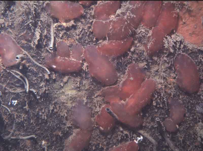
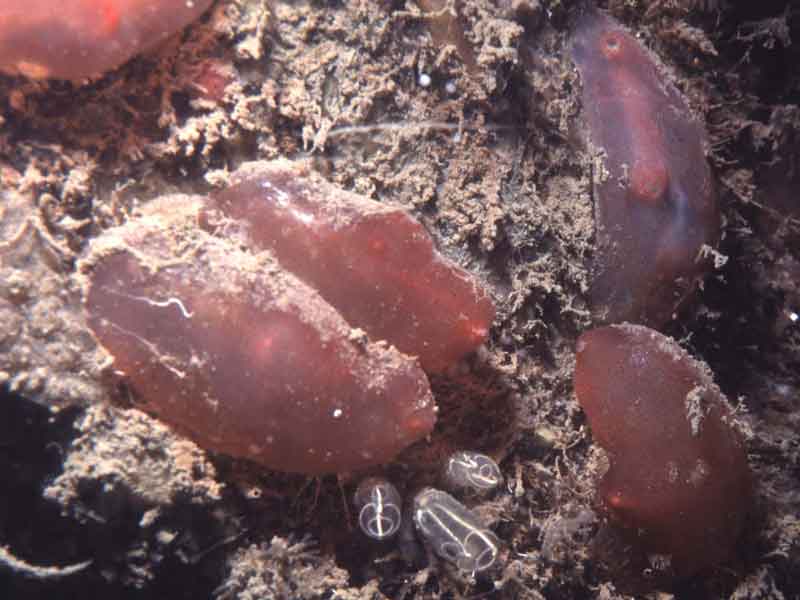
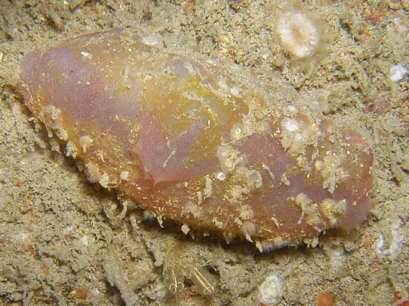
A sea squirt (Ascidia mentula)
Distribution data supplied by the Ocean Biodiversity Information System (OBIS). To interrogate UK data visit the NBN Atlas.Map Help
| Researched by | Sonia Rowley | Refereed by | Admin |
| Authority | Müller, 1776 | ||
| Other common names | - | Synonyms | - |
Summary
Description
Recorded distribution in Britain and Ireland
Ascidia mentula has been commonly recorded on the coasts of Britain and Ireland but with few records on the east coasts of England and Scotland.Global distribution
-Habitat
This species can be found on the lower shore down to 2300 meters depth. Often found in shaded gullies and crevices on the rocky shore and attached to Laminaria holdfasts but also on large shells and stones on sand and mud. This species is tolerant of salinities down to 20.Depth range
-Identifying features
- Large elongate body over 18 cm long.
- Thick, cartilaginous, translucent test.
- Usually red-pink or greenish-olive green but can be grey in deeper waters.
- Attached to the substratum on its left side.
- Small siphons; exhalant terminal, inhalant half to three quarters down the body.
Additional information
Ascidia mentula is fertilized externally and produces a tadpole larvae up to 0.8 mm in length, with a short planktonic phase. Breeding in this species occurs throughout the year but predominantly during the summer. The branchial sac of Ascidia mentula is commonly inhabited by the pea crab Pinnotheres pinnotheres or the copepod Notopterophorus papilio. The small bivalve Modiolarca tumida can also live commensally in the test. Ascidia mentula may be mistaken for Ascidia virginea which has a smooth, retangular, transparent rose-pink test with red veins on the mantle.Listed by
- none -
Bibliography
Bruce, J.R., Colman, J.S. & Jones, N.S., 1963. Marine fauna of the Isle of Man. Liverpool: Liverpool University Press.
Costello, M.J., Bouchet, P., Boxshall, G., Emblow, C. & Vanden Berghe, E., 2004. European Register of Marine Species [On-line]. http://www.marbef.org/data/erms.php,
Crothers, J.H. (ed.), 1966. Dale Fort Marine Fauna. London: Field Studies Council.
Dipper, R., & Powell. A., 1984. Field guide to the water life of Britain. London: Reader's Digest Association Limited.
Fish, J.D. & Fish, S., 1996. A student's guide to the seashore. Cambridge: Cambridge University Press.
Hayward, P., Nelson-Smith, T. & Shields, C. 1996. Collins pocket guide. Sea shore of Britain and northern Europe. London: HarperCollins.
Hayward, P.J. & Ryland, J.S. (ed.) 1995b. Handbook of the marine fauna of North-West Europe. Oxford: Oxford University Press.
Howson, C.M. & Picton, B.E., 1997. The species directory of the marine fauna and flora of the British Isles and surrounding seas. Belfast: Ulster Museum. [Ulster Museum publication, no. 276.]
MarLIN (Marine Life Information Network), 2005. SEArchable BEnthic Data (SEABED) Map [on-line]. Data Access Sub-programme, Marine Life Information Network for Britian and Ireland http://www.marlin.ac.uk,
MBA (Marine Biological Association), 1957. Plymouth Marine Fauna. Plymouth: Marine Biological Association of the United Kingdom.
Millar, R.H., 1970. British Ascidians London: Academic Press.[Synopses of the British Fauna, no. 1.]
Moen, F.E. & Svensen, E., 2004. Marine Fish & Invertebrates of Northern Europe. Southend-on-Sea: Aqua Press.
Naylor, P., 2003. Great British Marine Animals. Plymouth: Sound Diving Publications.
Picton, B.E. & Costello, M.J., 1998. BioMar biotope viewer: a guide to marine habitats, fauna and flora of Britain and Ireland. [CD-ROM] Environmental Sciences Unit, Trinity College, Dublin.
Datasets
Centre for Environmental Data and Recording, 2018. Ulster Museum Marine Surveys of Northern Ireland Coastal Waters. Occurrence dataset https://www.nmni.com/CEDaR/CEDaR-Centre-for-Environmental-Data-and-Recording.aspx accessed via NBNAtlas.org on 2018-09-25.
Fenwick, 2018. Aphotomarine. Occurrence dataset http://www.aphotomarine.com/index.html Accessed via NBNAtlas.org on 2018-10-01
Manx Biological Recording Partnership, 2022. Isle of Man historical wildlife records 1990 to 1994. Occurrence dataset:https://doi.org/10.15468/aru16v accessed via GBIF.org on 2024-09-27.
NBN (National Biodiversity Network) Atlas. Available from: https://www.nbnatlas.org.
OBIS (Ocean Biodiversity Information System), 2025. Global map of species distribution using gridded data. Available from: Ocean Biogeographic Information System. www.iobis.org. Accessed: 2025-08-09
South East Wales Biodiversity Records Centre, 2023. SEWBReC Marine and other Aquatic Invertebrates (South East Wales). Occurrence dataset:https://doi.org/10.15468/zxy1n6 accessed via GBIF.org on 2024-09-27.
Citation
This review can be cited as:
Last Updated: 03/07/2008


