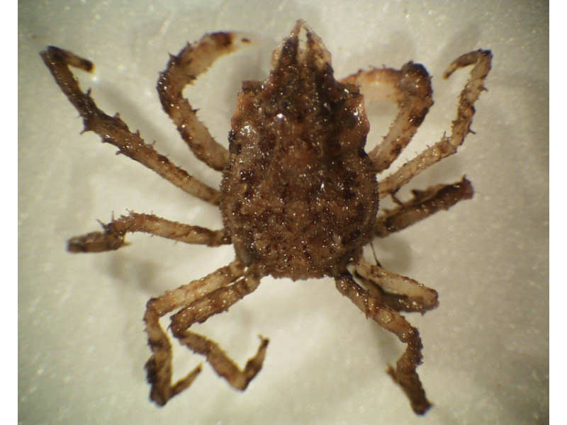
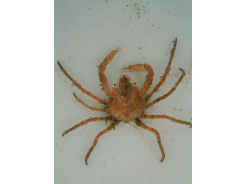
Toad crab (Hyas coarctatus)
Distribution data supplied by the Ocean Biodiversity Information System (OBIS). To interrogate UK data visit the NBN Atlas.Map Help
| Researched by | Morvan Barnes | Refereed by | Admin |
| Authority | Leach, 1816 | ||
| Other common names | - | Synonyms | - |
Summary
Description
Recorded distribution in Britain and Ireland
Found throught the British Isles but absent from the west coasts of Ireland.Global distribution
-Habitat
The toad crab is a benthic species found on both hard and sandy bottoms from the intertidal region down to a depth of up to 50 m.Depth range
-Identifying features
- Spider crab up to 61 mm in carapace length.
- Cornea of the retracted eye is visible from above and not concealed under the orbit.
- Post-orbital spine is flattened and expanded laterally.
- Basal antenna segment is less than twice as long as it is wide.
- Abdominal region is dilated laterally and, with the post-orbital region, forms a harp-shaped shelf.
Additional information
No text enteredListed by
- none -
Bibliography
Dyer, M.F., 1985. The distribution of Hyas araneus (L.) and Hyas coarctatus Leach (Crustacea: Decapoda: Brachyura) in the North Sea and the Svalbard region. Journal of the Marine Biological Association of the United Kingdom, 65, 195-201
Hayward, P.J. & Ryland, J.S. (ed.) 1995b. Handbook of the marine fauna of North-West Europe. Oxford: Oxford University Press.
Howson, C.M. & Picton, B.E., 1997. The species directory of the marine fauna and flora of the British Isles and surrounding seas. Belfast: Ulster Museum. [Ulster Museum publication, no. 276.]
Ingle, R., 1997. Crayfishes, lobsters and crabs of Europe. An illustrated guide to common and traded species. London: Chapman and Hall.
Picton, B.E. & Costello, M.J., 1998. BioMar biotope viewer: a guide to marine habitats, fauna and flora of Britain and Ireland. [CD-ROM] Environmental Sciences Unit, Trinity College, Dublin.
Datasets
Centre for Environmental Data and Recording, 2018. Ulster Museum Marine Surveys of Northern Ireland Coastal Waters. Occurrence dataset https://www.nmni.com/CEDaR/CEDaR-Centre-for-Environmental-Data-and-Recording.aspx accessed via NBNAtlas.org on 2018-09-25.
Environmental Records Information Centre North East, 2018. ERIC NE Combined dataset to 2017. Occurrence dataset: http://www.ericnortheast.org.ukl accessed via NBNAtlas.org on 2018-09-38
NBN (National Biodiversity Network) Atlas. Available from: https://www.nbnatlas.org.
OBIS (Ocean Biodiversity Information System), 2025. Global map of species distribution using gridded data. Available from: Ocean Biogeographic Information System. www.iobis.org. Accessed: 2025-08-02
Citation
This review can be cited as:
Last Updated: 07/04/2008


